
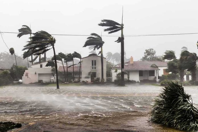
Downgrade does not mean safety; Lala’s shift from hurricane to tropical storm reduced peak wind speeds but left Hawaii squarely in the path of the hazards that most often inflict the damage—torrential rain, flooding, dangerous surf, downed power lines, and long-lived disruptions that outlast the eyewall by days.
At a Glance
- Tropical Storm Lala persisted as a high-impact system after weakening, with sustained winds near 65 mph and the center tracking just southwest of Honolulu.
- Hazards, not labels, drove risk: heavy rain bands, strong gusts over higher terrain, coastal flooding, and destructive surf across multiple islands.
- Emergency managers emphasized post-storm dangers—flooded roads, electrical hazards, debris, and generator safety—often where injuries and fatalities cluster.
- Hawaii’s warning architecture prioritizes hazard-specific guidance because public response lags when headlines shift from “hurricane” to “tropical storm.”
What Lala actually did: wind eased, impacts did not
By the time Lala weakened to a tropical storm, official trackers still put its maximum sustained winds around 65 mph and its center roughly 75 miles southwest of Honolulu—close enough for prolonged rain bands and onshore wind to keep piling water into vulnerable drainages and east- and south-facing coasts. State emergency management reinforced the point most people miss: a lower category number doesn’t switch off flood, surf, or debris threats, particularly where mountainous terrain amplifies runoff and wind accelerates over ridgelines and passes. Forecast discussions from the Central Pacific Hurricane Center called for tropical-storm-force winds with gusts near hurricane strength over Maui County, Oahu, and Kauai, with the strongest gusts over higher terrain as bands rotated across the island chain. Those conditions are exactly the recipe for the damage pattern Hawaii saw—fewer roofs peeled by core winds, more roads blocked by slides, power out for longer than the storm’s closest approach, and high surf gnawing at beaches and infrastructure.
Advisories evolved island by island as the center moved west-northwest. Warnings tapered where conditions improved but stayed in effect farther up the chain while rain and surf threats shifted. That geographic phasing can be confusing to the lay reader scanning a single headline; the operational signal was consistent in the full products—expect more water, more debris, and intermittent gale conditions as the storm passed and even after skies brightened.
Mechanism: why a “weaker” storm still floods and cuts power
Two physical processes explain why downgrades do not align with on-the-ground danger. First, the Saffir–Simpson scale measures peak sustained wind, not rainfall, storm size, or forward speed. Lala’s rain footprint—fed by persistent onshore flow and orographic lift over steep volcanic topography—produced what hydrologists call training bands: repeated convective bursts crossing the same watersheds. That stacks inches into feet quickly, overwhelms drainages, and destabilizes slopes primed for debris flows. Forecast guidance explicitly flagged additional heavy rain on windward flanks even after the core passed, and it warned that gusts to near hurricane strength would persist in favored terrain gaps.
Second, power and access cascades lag the wind maxima. Treefall and salt spray take down lines while soils are saturated; then utility crews face blocked roads, lingering lightning, and surf overtopping coastal routes. The hazard persists as a public-safety problem—downed live wires, carbon monoxide from misused generators, and secondary crashes at dark intersections—long after the meteorological center weakens or departs. Federal hurricane specialists routinely highlight generator placement and post-flood driving as life-safety priorities because, statistically, a nontrivial share of storm fatalities occur after skies clear. The Lala briefings and emergency messaging followed that playbook, urging residents to return only when declared safe and to treat floodwaters and downed lines as lethal until proven otherwise.
How Hawaii’s warning system frames storms like Lala
Hawaii’s emergency and forecast offices have spent years shifting risk communication away from a single categorical headline and toward hazard-location-timing-action messages. That architecture shows in Lala’s advisories and the state’s updates: where the winds will peak, which coasts will see dangerous surf, what hours bring the most severe flooding risk, and what to do about it. The approach aligns with social-science findings that people act more reliably when they receive concise guidance tailored to the hazard and place, rather than a generic storm label. Core elements include the nature of the hazard, the action to take, the location, the available lead time, and the source of the information; put differently, it tells residents what matters most now and what they can control.
The science also explains why a downgrade can lull behavior. When public attention migrates from “hurricane” to “tropical storm,” many unconsciously discount risk even as the hydro-meteorological setup for flash flooding is unchanged—or worsens as soils saturate. Research tied to U.S. warning practice has urged agencies to keep emphasizing consequence-driven statements—storm surge heights, surf zones, rainfall rates, and accessibility—for exactly this reason, and to repeat the post-impact hazards that drive preventable deaths and injuries. In Lala, both state and federal offices hewed to that guidance, visibly balancing label changes with specific, repeated hazard messaging.
The operational cadence: watches, warnings, and the handoff to recovery
Through Lala’s approach and passage, the cadence of products—watches, warnings, and forecast updates—tracked the storm’s evolution across the island chain. Tropical Storm Warnings were issued and, as conditions permitted, discontinued for islands that moved out of the core wind and rain while remaining in effect where bands still posed risk. The National Weather Service’s statewide hazard portal aggregated those changes into a readable map of active advisories, while the Central Pacific Hurricane Center’s public advisories distilled the essentials for non-specialists: anticipated wind thresholds, rainfall ranges, and surf impacts by island group. This sequencing matters for residents and for operations; it signals to utilities, hospitals, and local agencies when to surge resources, when to prioritize debris clearance over power restoration, and when to pivot to damage assessment.
By design, that final pivot—out of warning and into recovery—arrives while hazards persist. Flooded roadbeds can be structurally compromised even after waters recede; beaches and nearshore reefs battered by long-period swell may hide rip currents and unstable cuts. Emergency proclamations and local EOCs stay active for precisely that interval, smoothing the handoff from life safety to stabilization and early repair while maintaining public messaging around what not to do yet—drive into ponded water, wade near downed lines, or crowd coastal lookouts for photos during high surf.
What to learn for the next storm
Lala is a case study in the gap between storm labels and lived risk. Three durable lessons follow. First, treat “downgrade” as a wind statement only; if you live on a windward slope, near a stream, or along an exposed coast, your primary risks—runoff, debris flows, and surf—are largely unchanged until the moisture plume and seas relax. Second, plan for the post-storm window as rigorously as for landfall: generators, carbon monoxide alarms, medication access, and communications redundancies save more lives in that phase than tarps do. Federal briefings underscored generator distance and ventilation because misuse is a recurrent, preventable killer after tropical cyclones. Third, consume hazard-specific information from authoritative channels—the Central Pacific Hurricane Center, the Honolulu forecast office, and the Hawaiʻi Emergency Management Agency—rather than relying on a one-word label to infer threat level. Their products during Lala continuously specified where wind would peak, where rain would persist, and which coasts would see the most dangerous surf; that is the practical basis for good decisions.
Hawaii will see this pattern again. The archipelago’s relief, land-use patterns, and reliance on a few arterial roads make it exquisitely sensitive to long-duration rain and surf from large, slow-to-moderate moving tropical cyclones. Lala demonstrated, yet again, that the most consequential impacts often arrive after the banner headline changes—and that the messaging born of hard-won experience is the right compass through that ambiguity.
RESCUERS BECOMING THE RESCUED ON ARRIVAL 🚑🌊
Two Hawaii County paramedics responding to the chaos of Tropical Storm Lala on Saturday ended up having to scramble onto the roof of their own ambulance just to escape rising floodwaters.
Even the professionals taking the shift get…— Maria Mel (@Mariamelx58) August 17, 2026
Sources:
youtube.com, nhc.noaa.gov, hawaiicounty.gov